| These are introduction of Batavia City in
1942 |
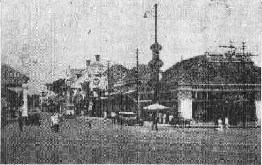 |
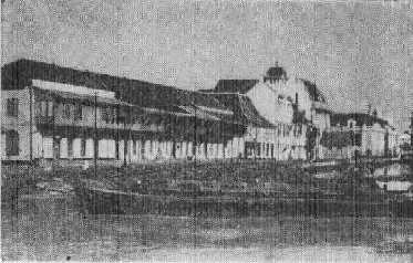
Mr. Prawoto, who was born in 1921 in Jakarta
told me that this photo was taken at
the
rail crossing at south of Juanda station
toward west direction.
Jalan Veteran can be seen straight.
There
was a river behind a shop at the right
corner.
A building at the left corner was a
famous
hotel and the place was reborn as a
shopping
mall. (2006-5-13 by Mr. Prawoto)
|
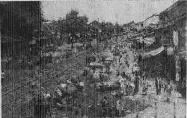 |
Near Pasar Senen.
|
 |
Kali Besar
Japan club and Japanese School located at
Chaulan Wei.
S6 09'56", E106 48'55"
Where is Chauran Wei? →Jl. KH Hasyim Ashyhai
This building was called as Lindeteves. Now
you can find shopping center named Lindeteves
near Glodok
(2006-5-13 by Mr. Prawoto)
|
 |
Bitung Kwitil (Old castle of Bavia)
Mr. Prawoto first told that he has never
heard such name. After he gassed a few minutes,
he realized that Bitung Kwitil must be "Pintu
Kecil" (Small gate). It is sure that
there is a name of area of Pintu Kecil. Further
there is a place called "Pintu Besar"
(Large gate) at the adjacent area.
Area inside of Pintu Kecil was a Chinese
Residential area and now it changed
into
Indonesian Wall Street, locating about
300
meters from Jakarta Kota Station toward
west
direction.
(2006-5-13 by Mr. Prawoto) |
 |
"Tailhermina" Park
Mr. Prawonto need a few hours to find
the
place, since the name was wrong and
it should
be "Willen Hermina". Hand
writing
draft of this book might be unclear
and the
type setter misread old character of
Japanese
language.
The National Mosque has been built
in this
park.
(2006-5-13 by Mr. Prawoto) |
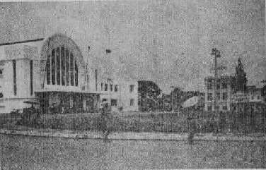 |
You must know this building.
As you know, this is a south entrance
of
Jakarta Kota Station.
Now you can get ride of City Express
Bus
"Jakarta Transport" which
connects
Kota Station and Block M terminal with
about
half an hour with tariff of abut 40
US cents.
See photos on another page of my website
|
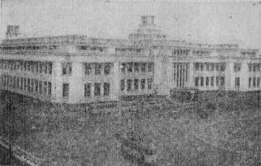 |
Batavia Factrite Corporation buildings
You can find this building in front
of Jakarta
Kota Station. The buildings at left
and right
sides are used by Bank Mandiri and
Bank Indonesia
respectively
(2006-5-13 by Mr. Prawoto) |
 |
These are the articles in the book which
is interesting.
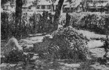
There is the Penang Gate in Caster Plane.
This gate is one of gates of the old Batavia
castle near Pasar Ikan. Now castle walls
were removed and the gate stands itself.A
four meter long canon of bronze with spherical
block at its end as shown on a photo shown
at right side of this article.
A sentence is seen on the gun barrel in Latin
which means that "I am reborn from myself".
Natives and Chinese call the canon as a holly
gun, since they have a superstition that
women will be impregnate once they hold the
gun and many people visit this gun. There
is a legend that this gun is a male one and
another female gun is now in Bantam and they
divorce now. An Indian like guy require a
fee at the place. He hides the "important"
part of the gun with steel plate, until pilgrims
give his money. Paper flowers are seen in
the photo which are piled up on the gun.
This gun is now exhibited in a museum
in
Jakarta.
(2006-5-13 by Mr. Prawoto) |
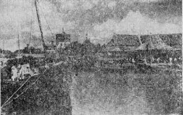 |
A part of Fish Market in Batavia
They use a building with tower at the
center
of this photo as the control office
for ships.
This is a part of old Batavia castle
wall
which is one meter thick with gun eyes
and
watch tower on the wall. |
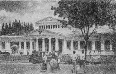 |
As you know well this old building. This
is a national museum at Jl. Merdeka
Barat.
New annex has been built at the right
side
of the building.
|
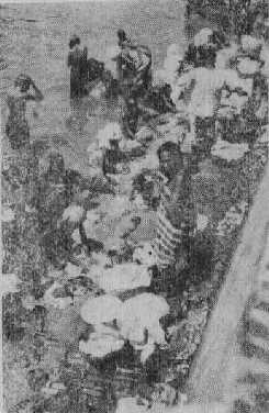 |
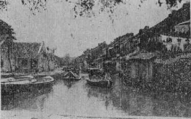
Mandi and washing clothes in a river at center
of Batavia City.
This river may be a river between Jl. Hayam
Wuruk and Jl Gajahmada in Kota.
Om Doyok witnessed a few man bathed with
the river water which smelled bad and polluted
in 1970th.
Water quality has improved after rehabilitation
of retaining wall along the river now
and
no bather has been seen.
Now we seldom find local people who
bathe
in creeks in country side as well.
They say
that local people have had own well
to take
water for bathing due to increasing
incomes.
|
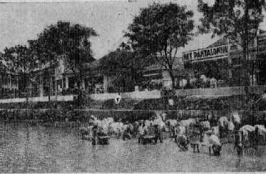 |
Scene of Washing Clothes by Laundry
We cannot imagine that there are old
villages
in city area from our common sense.
Imagine
that storage ponds for sewage water
exist
in planned residential areas in a new
city.
Washers are men but not women, since
the
volume is too large for woman to Finnish
washing the quantity in a day. Washed
clothes
are dried on the bamboo stands. Everything
are quite large.But the water they
use at
up and downstream this place is dirty.
No need to worry about quality of municipal
water. Japanese and European use clean
water
supplied by the governmental water
service.
We are anxious about epidemics through
the
river water, but it has not occurred,
since
the local government periodically dries
up
this river for sanitation of river
bed.
We do not accept that the water can
be clean
by belief of Islam . Even though they
are
brave enough to jump in such dirty
water
with help of the belief, it should
be understood
that they are immune against epidemics
as
same as Chinese against bedbugs. |
You can find old photos of Tempo Doeloe tahoen
1954 "Djalan Hajam Woeroek & Djembatan
Harmonie" on Google Earth. Check cordinate
at 6° 10' 5.02" S 106° 49' 13.94"
E
You can also find them at <http://www.panoramio.com//photo/14468517>
|